
The Rongai Route is the only path approaching Kilimanjaro from the north, near the Kenyan border. This remote route offers a wilderness experience with excellent wildlife viewing opportunities and less rainfall, making it ideal during the wet season.
Rongai's gradual ascent profile and pristine northern slopes provide excellent acclimatization. The route is less crowded than southern approaches and descends via Marangu, offering varied scenery. Perfect for those seeking solitude and a gentler climbing profile with high summit success rates.
Drive to remote Rongai Gate on the northern slopes near the Kenyan border. Register and begin trekking through agricultural farmlands transitioning into pine forests. The northern side receives less rainfall, offering drier conditions and clearer skies.
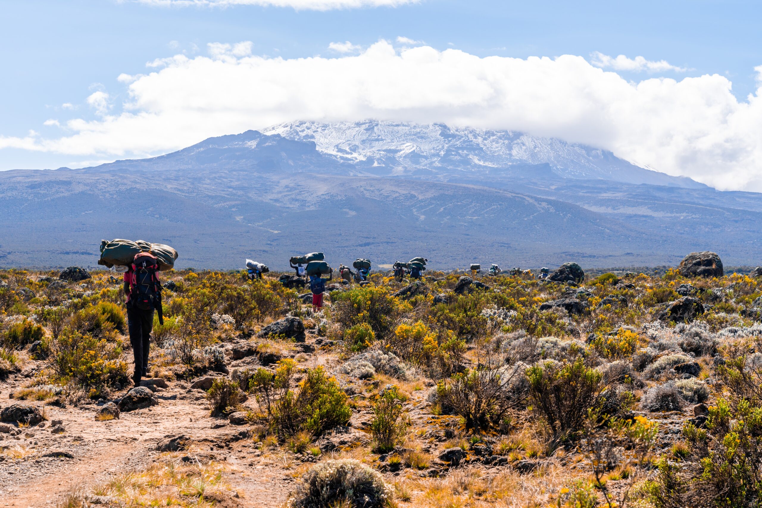
Trek through beautiful forest with excellent chances of spotting wildlife—colobus monkeys, various antelopes, and buffalo are common. The gradual ascent makes for comfortable first-day trekking, easing you into the mountain experience.
Simba Camp ("Lion Camp") sits at the forest edge where moorland begins. Enjoy your first mountain sunset with views toward Kenya. The remote location means fewer trekkers and a true wilderness atmosphere.
Ascend steadily through moorland with Kibo Peak coming into view. The trail offers spectacular panoramas of Kenya's vast plains to the north and Mawenzi Peak to the east. This gradual ascent aids acclimatization.
Second Cave Camp provides basic facilities with stunning views. The campsite sits beneath towering rock formations, offering shelter from wind. Clear nights reveal brilliant stars with minimal light pollution from this remote location.
Short trekking day allowing continued gentle acclimatization. Pass through increasingly sparse vegetation in the alpine zone. The landscape becomes more dramatic with towering rock formations and vast vistas.
Kikelelwa Camp offers spectacular views of Mawenzi's jagged peaks and the northern glaciers. This less-visited campsite provides tranquil mountain experience with minimal crowds, allowing you to absorb the pristine wilderness.
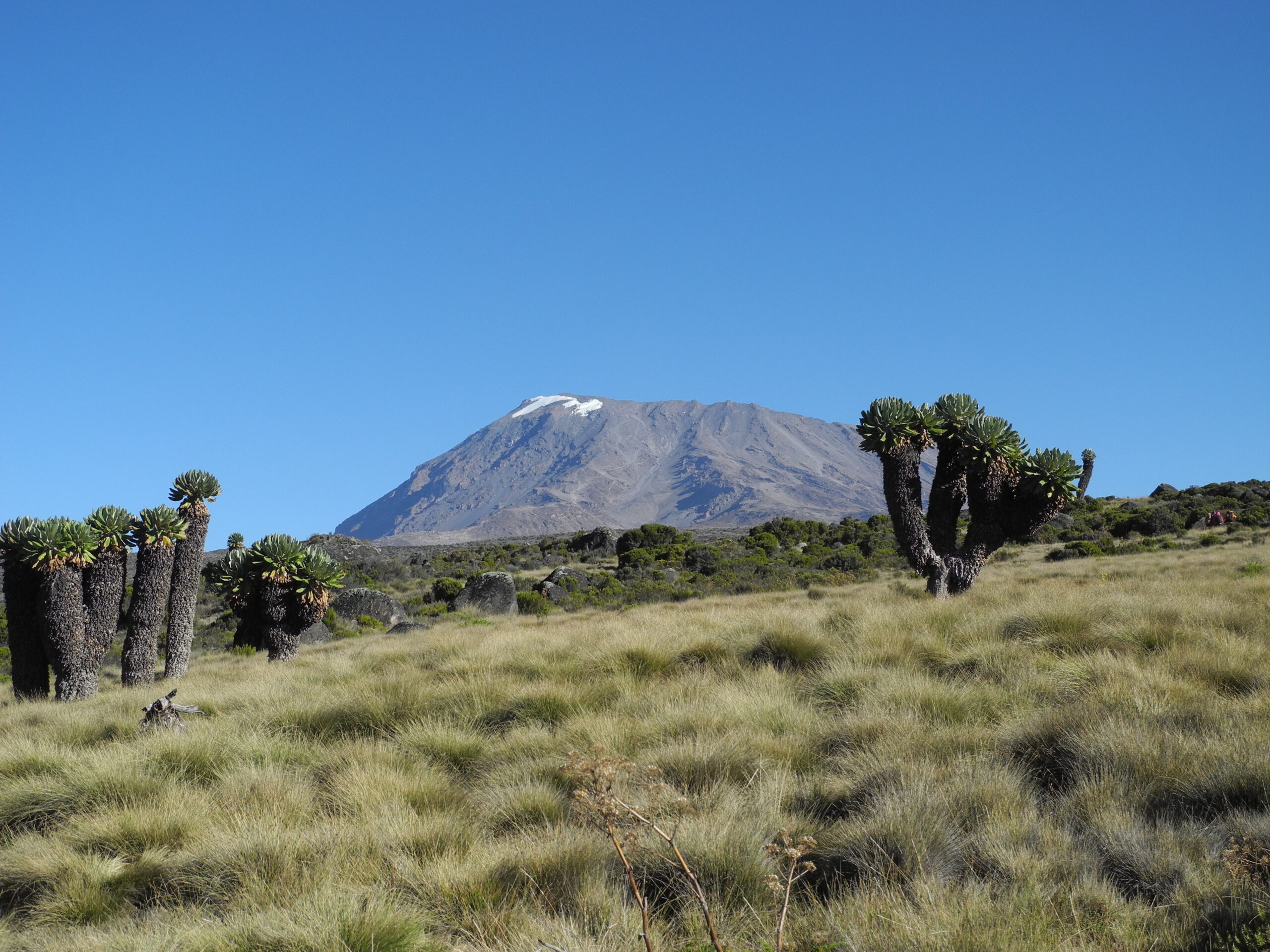
Trek into the alpine desert zone with sparse vegetation and dramatic volcanic landscapes. Ascend toward Mawenzi Peak's massive bulk, watching its jagged spires grow larger as you approach.
Mawenzi Tarn Camp sits at the base of Mawenzi's towering cliffs beside a pristine mountain tarn (small lake). This spectacular campsite offers some of Kilimanjaro's most dramatic scenery. Spend the afternoon acclimatizing with optional hikes around the tarn.
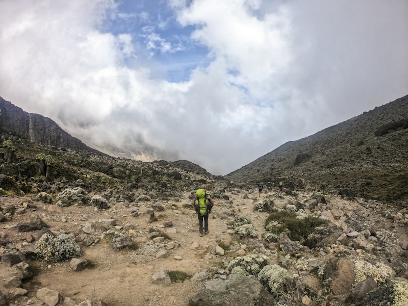
Cross the vast saddle between Mawenzi and Kibo—a barren lunar landscape of volcanic rock and dust. This high-altitude desert feels otherworldly and exposed, with Kibo's summit cone dominating the western horizon.
Kibo Camp sits at the base of the summit cone. Rest, hydrate, and prepare gear for tonight's midnight summit attempt. Most find sleep impossible at this altitude, but rest is crucial before the challenge ahead.
Summit night begins around midnight. Ascend steep scree to Gilman's Point (5,681m) on the crater rim, arriving at sunrise. Continue traversing the rim to Uhuru Peak (5,895m)—Africa's highest point! Celebrate your achievement before beginning the long descent.
Descend via Marangu Route to Horombo Huts for the night. This marathon day covers enormous distance and elevation change, but the varied descent route offers new scenery.
Final descent through moorland and lush rainforest to Marangu Gate. Collect your summit certificate, tip your crew, and celebrate your achievement. Transfer back to Moshi for hot showers and celebrations!
All prices are per person. Group discounts available for 4+ climbers.
Price includes: All park fees, camping fees, rescue fees, professional guides, porters, cook, camping equipment, all meals, drinking water. Excludes: Tips, personal gear, flights, visa, insurance, hotel accommodation.
Trek the remote northern route with minimal crowds and excellent wildlife viewing opportunities.
Gentle climbing profile with excellent acclimatization leads to high summit success rates.
Northern slopes receive less rainfall, ideal for climbing during wet season months.